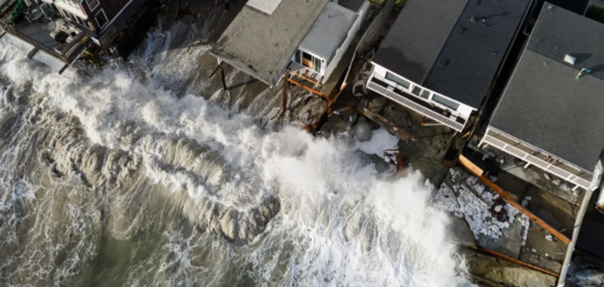

Billions in Potential Long-Term Property Damage Along California’s Coastline
San Francisco Bay communities, Newport Beach, Long Beach and coastal cities from Santa Cruz to Humboldt Bay face heightened risks of flooding, erosion and infrastructure damage during winter 2026-27, according to a new UC Davis report.
California’s coastal communities are entering the winter of 2026-27 facing an elevated threat of flooding and shoreline erosion as rising sea levels converge with what could be one of the strongest El Niño events in a century. From Newport Beach and Long Beach in Southern California to vulnerable communities surrounding San Francisco Bay, a combination of higher ocean levels, powerful storms and heavy rainfall could put homes, roads, airports and valuable coastal property at risk.
A new report by Fraser M. Shilling, Ph.D., director of the Road Ecology Center at the University of California, Davis, identifies six major geographic areas where coastal flooding could become particularly problematic this winter. The analysis highlights the growing vulnerability of California’s developed shoreline, including residential neighborhoods, commercial areas, agricultural land and critical transportation infrastructure.
Southern California: Newport Beach and Long Beach Already Showing Warning Signs
Southern California has already experienced a preview of the potential consequences. In October 2026, significant street flooding was observed along portions of the Long Beach coastline and the Newport Peninsula, despite the absence of exceptional hurricane-driven surf.
Shilling’s analysis indicates that the flooding was consistent with scenarios involving approximately two to three feet of additional water elevation, combining existing sea-level rise with major flood conditions.
These coastal communities face the possibility of further beach erosion, shoreline flooding and damage to beachfront property as elevated ocean levels and storm-driven waves intensify. The report cautions that some beach losses in Long Beach and Newport Peninsula could represent irreversible damage that even extensive sand replenishment and protective barriers may not resolve.
San Francisco Bay Area: Airports, Highways and Residential Communities at Risk
The San Francisco Bay Area emerges as one of the report’s most concerning regions because of its extensive development on former marshlands and low-lying filled land.
San Francisco International Airport and sections of adjacent U.S. 101 could be vulnerable to water-level increases of three feet or more. Oakland International Airport, despite recent levee improvements, remains exposed during extreme flooding events.
Other vulnerable locations include West Oakland, portions of the eastern approach to the Bay Bridge, South San Francisco Bay communities, and the marshlands surrounding San Jose, including Alviso and Renaissance. Approximately two feet of additional water elevation could flood portions of these residential areas.
Further north, Corte Madera and San Rafael face significant exposure. Low-lying sections of U.S. 101, local roads, marshes and residential neighborhoods could experience flooding from the combined effects of high tides, rising seas and stormwater runoff. San Rafael’s Canal Area is identified as particularly vulnerable.
Highway 37 and North Bay Communities Face Serious Threat
One of the report’s most significant warnings concerns the North San Francisco Bay, particularly Highway 37 and surrounding communities near Novato Creek, Petaluma River, Tolay Creek and Mare Island.
Highway 37 has flooded twice in the past decade, in 2017 and 2023, with closures lasting weeks. Although a bridge replacement project has been proposed, construction is not expected until 2027 or later, leaving the existing roadway exposed.
An even greater concern involves the levees east of the Petaluma River, where aging and poorly maintained protective structures could be overtopped during extreme water conditions. A failure could inundate extensive agricultural areas and temporarily close Highway 37.
Central and Northern California Also Exposed
Further south, Moss Landing and the Elkhorn Slough area could experience flooding affecting local roads, agricultural fields and marshlands. Santa Cruz faces potential beach loss, shoreline erosion and localized flooding near San Lorenzo Creek.
Avila Beach and Pismo Beach in San Luis Obispo County also face moderate risks from coastal flooding, erosion and stormwater runoff.
Along the Marin County coastline, Stinson Beach is particularly exposed. Beachfront homes, local roads and the primary access route could face flooding, while Highway 1 near Bolinas Lagoon is vulnerable under more extreme water-level scenarios.
Farther north, Humboldt Bay communities face potential flooding affecting local roads, agricultural fields, marshes and portions of U.S. 101.
Billions in Potential Long-Term Damage
The report places this winter’s risks within a much larger economic challenge. California’s coastline has already experienced approximately one foot of sea-level rise, while projections cited in the study indicate another 36 to 66 inches could occur by 2100.
Shilling warns that the financial consequences of repeated flooding, erosion, infrastructure failures and coastal property damage could eventually escalate from tens of millions of dollars into hundreds of millions and ultimately billions.
He argues that investing in shoreline resilience, infrastructure adaptation and ecosystem protection now would cost considerably less than responding to repeated disasters.
The report’s central message is that California’s coastal vulnerabilities have been documented by scientists for years. The challenge is translating that research into meaningful government action before more communities, properties and essential infrastructure experience permanent damage.
As another potentially powerful El Niño approaches, the coming winter could provide a consequential test of how prepared California is for the growing economic and physical realities of rising seas.

Sign Up Free | The WPJ Weekly Newsletter
Relevant real estate news.
Actionable market intelligence.
Right to your inbox every week.
Real Estate Listings Showcase
Please visit:
Our Sponsor
